Database Changelog
Track recent changes and additions to the AirportRoutes database
Recent Activity Summary
Flight Observed: KAP8380 (KBHB → KBOS)
Airline: KAP
Aircraft: C402
Route: Bar Harbor → Boston
Flight Observed: TIN701 (CYZF → CGK2)
Airline: TIN
Aircraft: DHC7
Route: Yellowknife → Kennedy Lake
Flight Observed: TIN706 (CYXE → CYPA)
Airline: TIN
Aircraft: DHC7
Route: Saskatoon → Prince Albert
Flight Observed: KFS169 (KRST → KTKI)
Airline: KFS
Aircraft: LJ35
Route: Rochester → Dallas
Flight Observed: MMD500 (KBED → ESSB)
Airline: MMD
Aircraft: FA8X
Route: Bedford → Stockholm
Flight Observed: GPD202 (KBED → KEWB)
Airline: GPD
Aircraft: PC12
(N202TW)
Route: Bedford → New Bedford
Flight Observed: AMF2869 (KPRC → KPHX)
Airline: AMF
Aircraft: SW4
Route: Prescott → Phoenix
Flight Observed: AIP1407 (KMOT → KFAR)
Airline: AIP
Aircraft: B190
Route: Minot → Fargo
Flight Observed: TAM8194 (SBGR → KMIA)
Airline: TAM
Aircraft: B77W
Route: Sao Paulo → Miami
Flight Observed: TZP24 (RJAA → KLAX)
Airline: TZP
Aircraft: UNKNOWN
Route: Tokyo (Narita) → Los Angeles
Airline Info Updated: Air New Zealand
ICAO: ANZ
Content: About, traveler sentiment, and safety information
Airline Info Updated: Baker Aviation,
ICAO: KOW
Content: About, traveler sentiment, and safety information
Airline Info Updated: Buzz
ICAO: RYS
Content: About, traveler sentiment, and safety information
Airline Info Updated: Uzbekistan Airways
ICAO: UZB
Content: About, traveler sentiment, and safety information
Airline Info Updated: Wings Abadi
ICAO: WON
Content: About, traveler sentiment, and safety information
Airline Info Updated: Hop-a-Jet
ICAO: HPJ
Content: About, traveler sentiment, and safety information
Airline Info Updated: Smart Lynx
ICAO: ART
Content: About, traveler sentiment, and safety information
Airline Info Updated: Akasa Air
ICAO: AKJ
Content: About, traveler sentiment, and safety information
Airline Info Updated: Aliserio
ICAO: TJD
Content: About, traveler sentiment, and safety information
Airline Info Updated: NetJets Aviation
ICAO: EJA
Content: About, traveler sentiment, and safety information
Airport Analysis Updated: Chinua Achebe International Airport (DNAN)
Location: Umuleri, NG
Content: Traveler sentiment analysis and airport experience insights
Airport Analysis Updated: Matetsi North 1 Airstrip (ZW-0065)
Location: Hwange, ZW
Content: Traveler sentiment analysis and airport experience insights
Airport Analysis Updated: Cincinnati Municipal Airport Lunken Field (KLUK)
Location: Cincinnati, US
Content: Traveler sentiment analysis and airport experience insights
Airport Analysis Updated: Beirut Rafic Hariri International Airport (OLBA)
Location: Beirut, LB
Content: Traveler sentiment analysis and airport experience insights
Airport Analysis Updated: Ezhou Huahu Airport (ZHEC)
Location: Ezhou, CN
Content: Traveler sentiment analysis and airport experience insights
Airport Analysis Updated: Malamala Airport (FAMD)
Location: Malamala, ZA
Content: Traveler sentiment analysis and airport experience insights
Airport Analysis Updated: Beijing Daxing International Airport (ZBAD)
Location: Beijing, CN
Content: Traveler sentiment analysis and airport experience insights
Airport Analysis Updated: Greater Moncton Roméo LeBlanc International Airport (CYQM)
Location: Moncton, CA
Content: Traveler sentiment analysis and airport experience insights
Airport Analysis Updated: Amsterdam Airport Schiphol (EHAM)
Location: Amsterdam, NL
Content: Traveler sentiment analysis and airport experience insights
Airport Analysis Updated: Abha International Airport (OEAB)
Location: Abha, SA
Content: Traveler sentiment analysis and airport experience insights
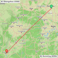
Flight Map Generated: ZHCC-ZPPP
Route: ZHCC → ZPPP
Type: Great-circle mathematical approximation
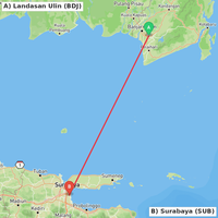
Flight Map Generated: WAOO-WARR
Route: WAOO → WARR
Type: Great-circle mathematical approximation
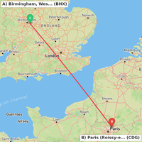
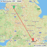
Flight Map Generated: EGBB-LFPG
Route: EGBB → LFPG
Type: Great-circle mathematical approximation
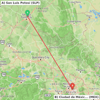
Flight Map Generated: MMSP-MMMX
Route: MMSP → MMMX
Type: Great-circle mathematical approximation
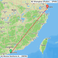
Flight Map Generated: VMMC-ZSPD
Route: VMMC → ZSPD
Type: Great-circle mathematical approximation
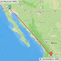
Flight Map Generated: MMML-MMGL
Route: MMML → MMGL
Type: Great-circle mathematical approximation
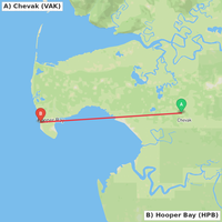
Flight Map Generated: PAVA-PAHP
Route: PAVA → PAHP
Type: Great-circle mathematical approximation
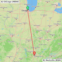
Flight Map Generated: KMDW-KBNA
Route: KMDW → KBNA
Type: Great-circle mathematical approximation
Flight Map Generated: EGCC-EGLL
Route: EGCC → EGLL
Type: Great-circle mathematical approximation
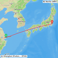
Flight Map Generated: ZSPD-RJAA
Route: ZSPD → RJAA
Type: Great-circle mathematical approximation
Airline Logo Added: El-Buraq Air Transport
Airline: El-Buraq Air Transport
ICAO: ELZ
File Size: 2.8 KB

Airline Logo Added: Colorful Guizhou
Airline: Colorful Guizhou
ICAO: CGZ
File Size: 2.8 KB


Airline Logo Added: Nordwind Airlines
Airline: Nordwind Airlines
ICAO: NWS
File Size: 1.6 KB

New Airport Added: Gayland Airport
Location: Fort Gay, US
Type: Small_Airport
ICAO: US-12835
New Airport Added: Hialeah Airport / 54th Street Aviation Field
Location: Hialeah, US
Type: Closed
ICAO: US-12837
New Airport Added: Wyatt Airport
Location: Elizabeth City, US
Type: Small_Airport
ICAO: 79NR
New Airport Added: Giggity Acres Airport
Location: DeWitt, US
Type: Small_Airport
ICAO: 43IA
New Airport Added: Shipley Field
Location: Tremonton, US
Type: Small_Airport
ICAO: 55UT
New Airport Added: Tides Inn Seaplane Base
Location: Irvington, US
Type: Seaplane_Base
ICAO: 74VG
New Airport Added: Bennett Acquisitions Helipad
Location: New Roads, US
Type: Heliport
ICAO: 67LA
New Airport Added: Elk Haven Landing Heliport
Location: McCall, US
Type: Heliport
ICAO: 5ID5
New Airport Added: Wheatley Helipad
Location: Wheatley, US
Type: Heliport
ICAO: 7AR4
New Airport Added: Parts and Sparks Airport
Location: Bunnell, US
Type: Small_Airport
ICAO: US-12836
New Comment on Mano Dayak International Airport (DRZA)
I_Am_So_Handsome
Renew the comments
New Comment on Mariehamn Airport (EFMA)
I_Am_So_Handsome
First comment.
New Comment on Hollywood Burbank Airport (KBUR)
I_Am_So_Handsome
Renew the comments
New Comment on Diego Garcia Naval Support Facility (FJDG)
I_Am_So_Handsome
re: Famous place!
New Comment on Hoima International Airport (under construction) (UG-0013)
I_Am_So_Handsome
First comment.
New Comment on Ganja International Airport (UBBG)
I_Am_So_Handsome
First comment.
New Comment on Nadzab Airport (AYNZ)
I_Am_So_Handsome
Renew the comments
New Comment on Gelephu Airport (VQGP)
I_Am_So_Handsome
First comment.
New Comment on Muscat International Airport (OOMS)
I_Am_So_Handsome
Renew the comments
New Comment on Salalah Airport (OOSA)
I_Am_So_Handsome
Renew the comments
Last Updated: January 30, 2026 6:48 AM UTC
Changes are tracked automatically as data is updated from various aviation sources.